_____AGUAYOS CIRCULAR TREKING_____ |
It is perhaps the most ambitious route throughout this guide: Walking a long distance, requires experience in guiding and places of transiting very different condition. It is indicated only for those who are used to walking through the woods and have some physical form as it is 6 to 7 hours away. Now the award are spectacular views, forests, meadows and a whole day of walking varied, entertaining and very few visitors ahead (normal is not seeing anyone). Comment anyway we have the option of using combination of vehicles, shortening the route until 5am. To do this we stop a car previously in section G of this route. Hours .....: 6 or 7 hours the entire route. 4.5 or 5 h to point G of travel (required combination of vehicles). Difficulty ..: High (necessary experience and fitness). Period .......: All year (In winter there may be snow on the top) |
|
_________________LOCATION MAP__________________ |
|
|
|
___________________DETAILED DESCRIPTION____________________ |
|
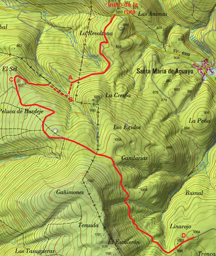
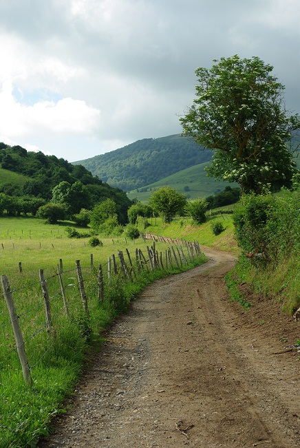
Between mile markers 149 and 150, the N611 comes a detour to climb Santa Maria de Aguayo. This climb a small port on the highway SV-6106. Upon reaching a small hill, after a very long straight, and very high, you have to be very attentive to a track off to the right, into the woods. Here we leave the car. |
|
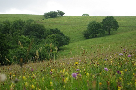
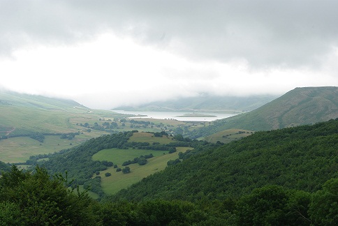
The route starts using that track, sometimes very muddy, to go more or less along the hillside the head of Arroyo Buldeje, up to a small hill where the road turns to the northwest along the crest of a gentle descent rope. In that hill (Point A, 30 min), we leave the track and continue in the direction that we brought before reaching the hill, all the way south, descending. We follow what must have been a PR, because there are wooden stakes marked in red bank, but today it is very difficult to identify as they are just a couple of them, but enough to indicate the direction. We crossed a fence by a right step to this end (a sign that the route should be marked) and continue down what is sensed by a road, until we came to a place with a trough at the bottom of a valley with no name (Point B, 45 min). From there, a path that moves along the hillside without losing altitude to the right as you come to it, in the sense of the stream (Northwest), the slope opposite to the one we used to go down to trough. Soon you come to a road that runs up and smearing, making the progression a bit "heavy" until it comes to a clear area (point C, 1 h). It's a place called (as so often) Sel, and is situated 907m above sea level. The views Besaya Valley are unique, the atmosphere is wonderful peaceful and quiet, broken only by the ringing of bells and the wind, which in this part is usually present. If fog is best turned us because here are visual references for a while. |
|
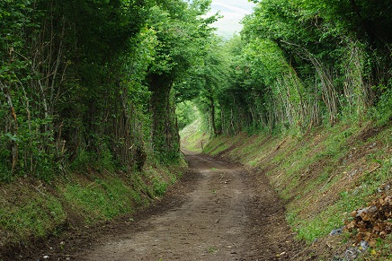
The route starts using that track, sometimes very muddy, to go more or less along the hillside the head of Arroyo Buldeje, up to a small hill where the road turns to the northwest along the crest of a gentle descent rope. In that hill (Point A, 30 min), we leave the track and continue in the direction that we brought before reaching the hill, all the way to the south, primarily to climb, looking for a wagon road that sometimes is not visible , coming from below, which appears in the IGN maps (1:25000) and is visible from the photos of SIGPAC (it is important to find). The road also seeks to funnel into the woods toward which we are heading and that increasingly surrounds us harder, until it makes its way on through a dark hole and curious after which we went to another praderío where without ever losing the way, arrive between groves of oak to the north face of Escalerón: a steep set with menacing appearance that appears on the right, to the south. The road continues along the hillside or in slight decline. There are several doors to go through, and mud may make its appearance, but the atmosphere of solitude and the views over the river valley and the reservoir Irbienza backdrop Alsa are first. Gradually, we walk along the hillside across the steep northern slope of Escalerón to suddenly taken away from him and going northeast through some meadows. You have to drive for about 150m the road in that direction. (Point D, 2h 30min and if all went well and walk at a brisk pace). |
|
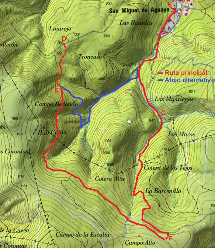
The route starts using that track, sometimes very muddy, to go more or less along the hillside the head of Arroyo Buldeje, up to donate a small pass that point you have to leave the track and head south, no tracks, only with the sketch map (fundamental) and compass. It is the most complicated of the route since no references and must correctly identify where we are and where we want to go: we must find a path through the headwaters Irbienza at birth and the route described in Cotera Alta. But to find it we must, as we said, first through the meadows to the south, at first on a gentle hill and then descending a hillside. It is very important to visualize the point as we go, and we sense right at the back, in a corner of praderío. The place is the connection to the track that runs through the lush forest that occupies Irbienza header to where we are heading. Under normal conditions should not represent more than 20 minute descent to reach him. To gain entry to the road you have to overcome a muddy stream bed and look over a curtain of brambles, but at this point should not pose any difficulty (Point E, 2 h 50 min, maybe 3h). |
|
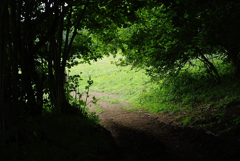
If we find it is almost finished orientation difficulties. Once on the road (also very muddy) must climb. To do this we follow to the right, and do not leave until you leave the forest after a long stretch in which the landscape looks like something out of an adventure novel: trees in a thousand ways, fleeting views of the valley below us opens the body treetops and solitude broken new case by tudanca some distant bells. Mention here that if the point E instead of climbing down the path we take, we also to San Miguel de Aguayo reducing over an hour on the road, no more inconvenience occupying mud track. |
|
When we left the forest, as described in the High Cotera route in reverse, we must find a path that runs parallel to 50m below us, and again the gorse us from viewing and get to it. So we must always remain vigilant to turn left (down) to find it, or if you are feeling brave crossing the sea of gorse ... the fact is that with a little patience, if we continue down the road you will reach a meadow open where we can look calmly down the track (Item F of 3h and 30min to 4h), which will not leave. If in doubt, take the following descending and is wider or is paved (a luxury after spending so much mud). In just over half an hour and we will definitely enfilaremos forest road down to San Miguel de Aguayo. (Point G, 5h). |
|
When we left the forest, as described in the High Cotera route in reverse, we must find a path that runs parallel to 50m below us, and again the gorse us from viewing and get to it. So debemEn this point we have stopped a car and by combining all vehicles return to the starting point. From now on the route travels partly by tracks, and a stretch along the road SV-6106. |
|
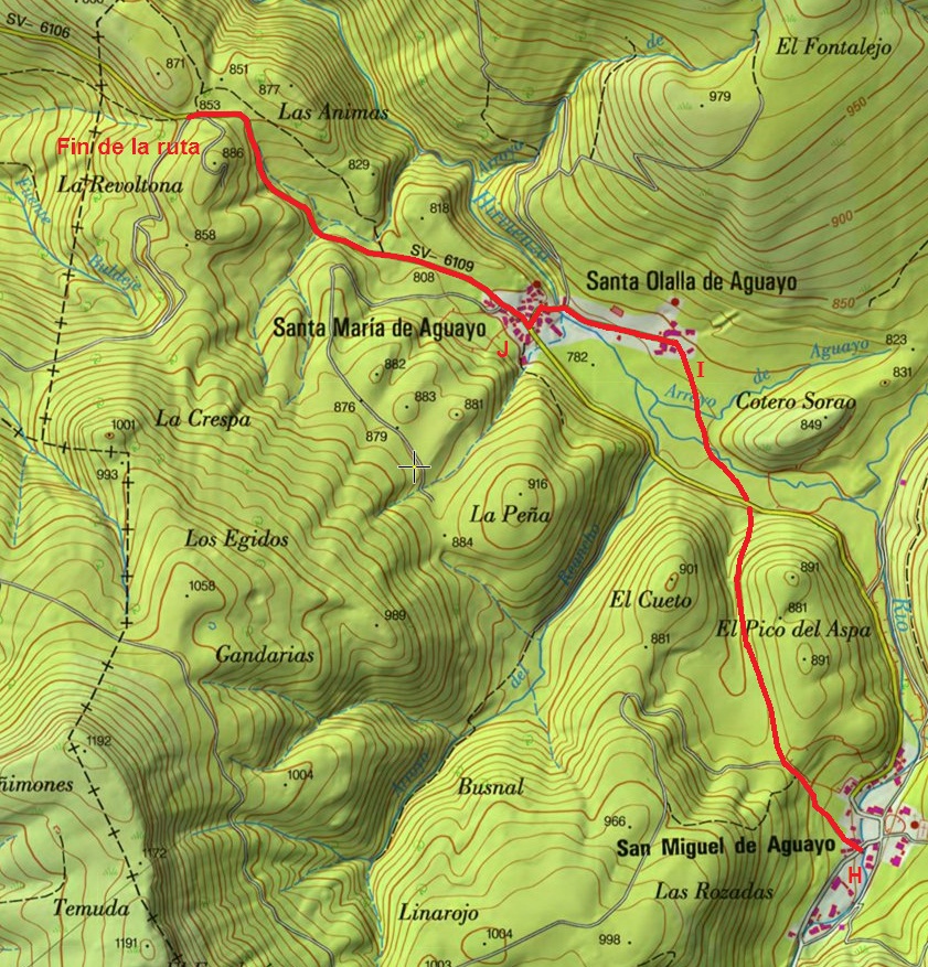
If we decided to make the entire journey by road to reach San Miguel de Aguayo. In the middle of town is a path to the left, explicitly documented with a photo * (Point H, 5h and 30 min), we need to tackle to catch Santa Olaya de Aguayo. A 350m track splits and take the right one. The route now passes through a lovely combination of meadows, hedgerows and streams, and leads to Santa Olaya de Aguayo across the SV-6106 and continuing on the other side the same way. |
|
From Santa Olaya (Point I, 6h) continue along a small road to the west for a few hundred meters, cross a small bridge Irbienza river and reached Santa Maria Aguayo (Point J, 6h 15 min). They turn on the SV-6106 on the right, heading west until colladito where we left the car, where the walk ends. In total 6 or 7 hours. |
|
Remember as a final note that this route is varied and recommended, but it is necessary to bring warm clothing, food, an insulator to sit on the floor to eat and rest, with the sketch map, compass and especially experience in evaluating their own individual capacity and objective difficulties. |
|
We hope you enjoy it as much as us. |
|
|
|
________________________________ROUTE MAP_________________________________ |
|
|
|
|
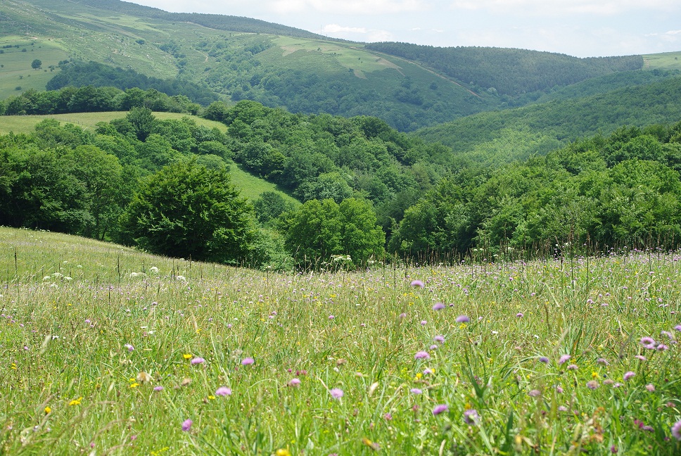
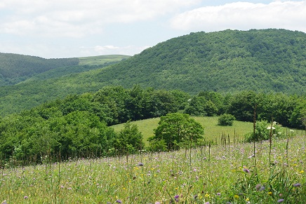
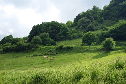
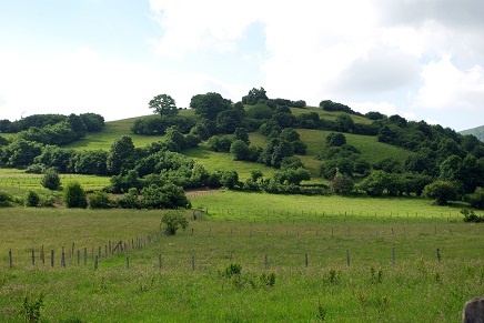
______________________________________FOTOS________________________________________ |
|
|
|
|
|
|
|
|
|
