__ASCENSION TO SEJOS AND CUETO DE LA HORCADA__ |
The hill is Sejos is one of those curious and aesthetic places that mark the geography of the province, but few dare to visit. This route has almost everything: the best atmosphere of forest gap (if it comes to the Horcada cueto are uploaded 1500m) high mountain environment (the north face of the Horcada Cueto is awesome), megalithic remains, views spectacular (to us appears first Polaciones the region of the bottom and the massifs of the Picos de Europa) ... well, it's highly recommended and complete, but also very demanding, only suitable for skilled people, especially if it goes to Cueto . Estimated time.....: From approx 6-8 hours as each. Difficulty ..: Very difficult to Cueto de la Horcada. Period .......: In normal winter ice from Sejos, experts only ... |
|
___________________________LOCATION MAP__________________________ |
|
|
|
______________________________DETAILED DESCRIPTION______________________________ |
|
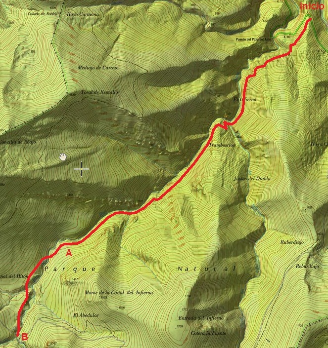
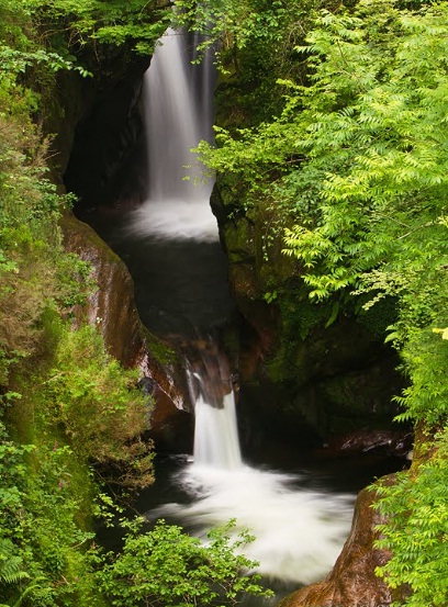
Between 16 and 17 km point of the AC-280, near the famous Pozo del Amo (waterfall that plunges into a pot aesthetic amid a gorge), and as you climb to the port of Palombera, a small car park on the right, which we will use as the start of the route. |
|
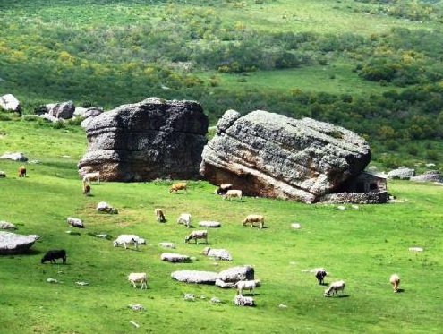
A few hundred feet below the parking lot, on the same side of the road, get a well marked path that ascends into the forest (650m altitude). Continue for him, amid a dense beech forest, moist and lovely, ignoring the branches that appear. The road goes along the river, we always go to our right, to pastures and Sejos brañas. We trust him and follow him even though sometimes suddenly empine or llanee other. Leaving behind a curious rock formation across the river called the "Molinucos the devil", the thick beech, oak and birch that appear depending on the altitude, and plenty of charming corners that are happening at every step, until begins to thin the forest and the valley opened, about 1200m above sea level (Point a, 1h and 45min). We have already gone a long way, now the river descends on meadows, and the road crosses it several times always seeking the most favorable. She is joined by rivulets left and right and the road becomes less obvious. We always follow the river, not away from it, until before us an excellent track that crosses (Point B, 2h 15min). |
|
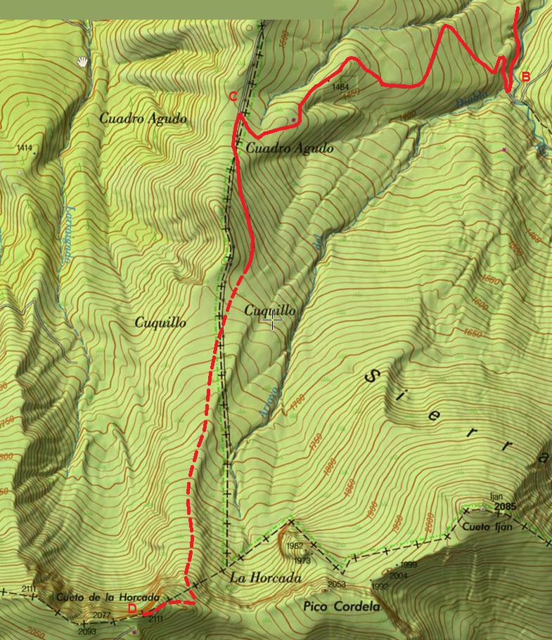
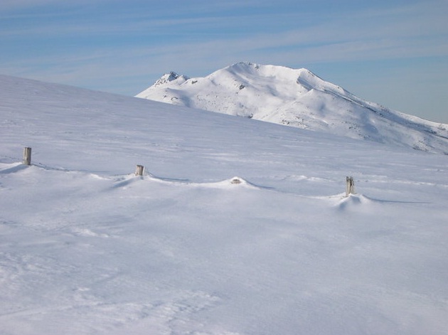
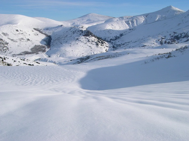
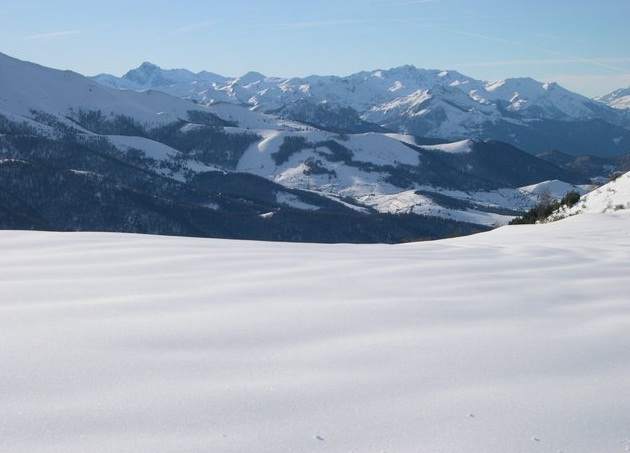
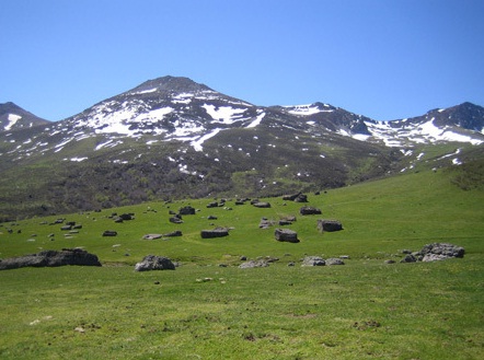
We follow the trail to the right as we find it, up until we left on the hill of Sejos (Point C, 2h 45min), with brañas the same name surrounding us everywhere. The ascent is marked by conglomerate stone forests of the glacier first tore the tops to drop to the ice retreat. Ahead of us are magnificent views of the region of Polaciones, and beyond the Liébana and Eastern and Central massifs of the Picos de Europa. Southbound see the north face of the Horcada Cueto, to where we will go after enjoying the peaceful place where we are. To the north, close, another hill, the Hiton. If we approach we can see the remains of megalithic cultures. |
|
To ascend the Horcada Cueto followed a rutted track that ascends southward and disappears soon to become a path we getting closer to the top, through the rope. From now to look for the best option to go up, we must be careful and turn a little to the east (left) looking a slope slightly less strong and then turn west, straight to the peak and a little along the hillside to stepping on the rope and then the top (point D, 4h). Say here that while there is pending danger rising and we must learn to move, so we recommend caution and responsibility when undertaking this last stage of the route, from the hill of Sejos to Cueto. |
|
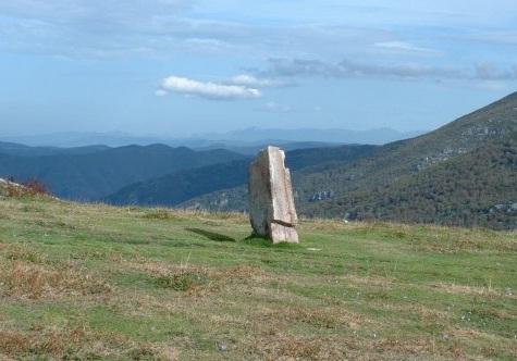
From the top the views are spectacular if possible, especially north because at the south is the ski resort of Alto Campoo. Are worth seeing patiently, enjoying the wind and the peace of the place. |
|
The decline is in the same place, considering that the distance is much that has been traveled and altitude exceeded, the drop also cost time and hours (at least 2, maybe more). |
|
______________________ROUTE MAP_______________________ |
|
|
|
|
|
|
|
|
|
