|
___________IRBIENZA RIVER ROUTE__________ |
Short version of the "Water Trail" (which otherwise is lost and is hard to follow). This described here follows the river Irbienza through it several times in a majestic beech as fairytale, cool and peaceful, to ascend to a brañas with stunning views over the valley. Hours .....: 1 to 1.5 hours. Difficulty..: Easy. Period .......: All year |
|
_____________________________LOCATION MAP____________________________ |
|
|
|
______________________________DETAILED DESCRIPTION______________________________ |
|
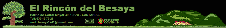
At kilometer 151 of the N611, between Pesquera and Concha Bárcena floor there is a small parking lot, away from the road for a few conifers planted as a hedge next to Besaya huge, in that lower area encased in one of sickles. From there, you have to walk about 100m down the road towards Fisheries (South, Reinosa direction) until the left side of the road is a track with a wooden door, that's the beginning of the route. |
|
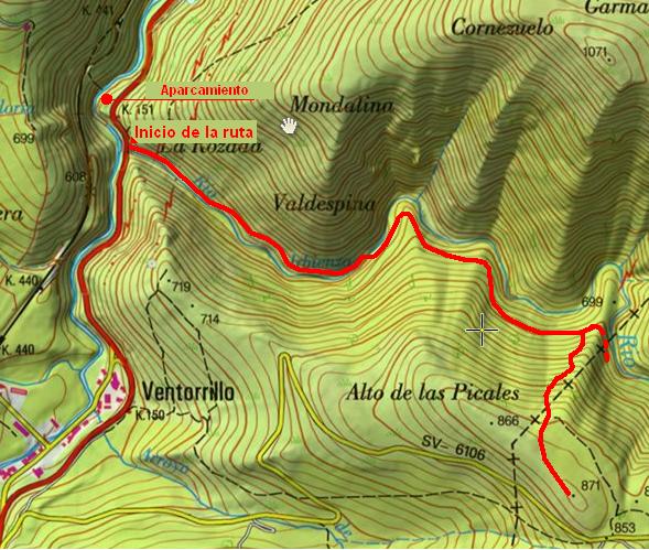
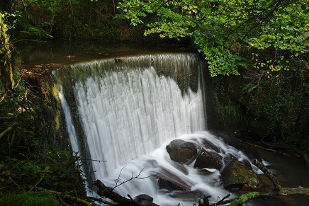
The road climbs gently surrounded by young trees to the left, and the murmuring river Irbienza right, be with us most of the way. This just crossing in the middle of a natural environment by winning moments, but not before leaving a beautiful waterfall right on a slope anquísimo masonry, signal other times. |
|
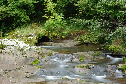
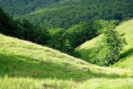
Just after crossing the river the road climbs and narrows, to enter a specific monkey beech barely lets light that runs along the floor with a blanket of dry leaves of autumn forgotten. Soon, a road to the right very steep slope attacking frontally, a peak, and we continue to rise to a vented brañas bright, high on a hill. Close by the road passes SV-6106, which goes to San Miguel de Aguayo, where there is another route described in this guide. The return is in the same place. |
|
Remains to be seen whether it is possible to continue the route Irbienza partner, to Santa Maria de Aguayo, enough for now detail this short tour, sure we will enjoy environments and views. |
|
The descent follows the same route, taking extreme caution to avoid falling in the slips uncomfortable walking through the woods to reach the road and then to the track. |
|
|
|
______________________ROUTE MAP_______________________ |
 |
|
______________________________________PHOTOS________________________________________ |
|
|
|
|
